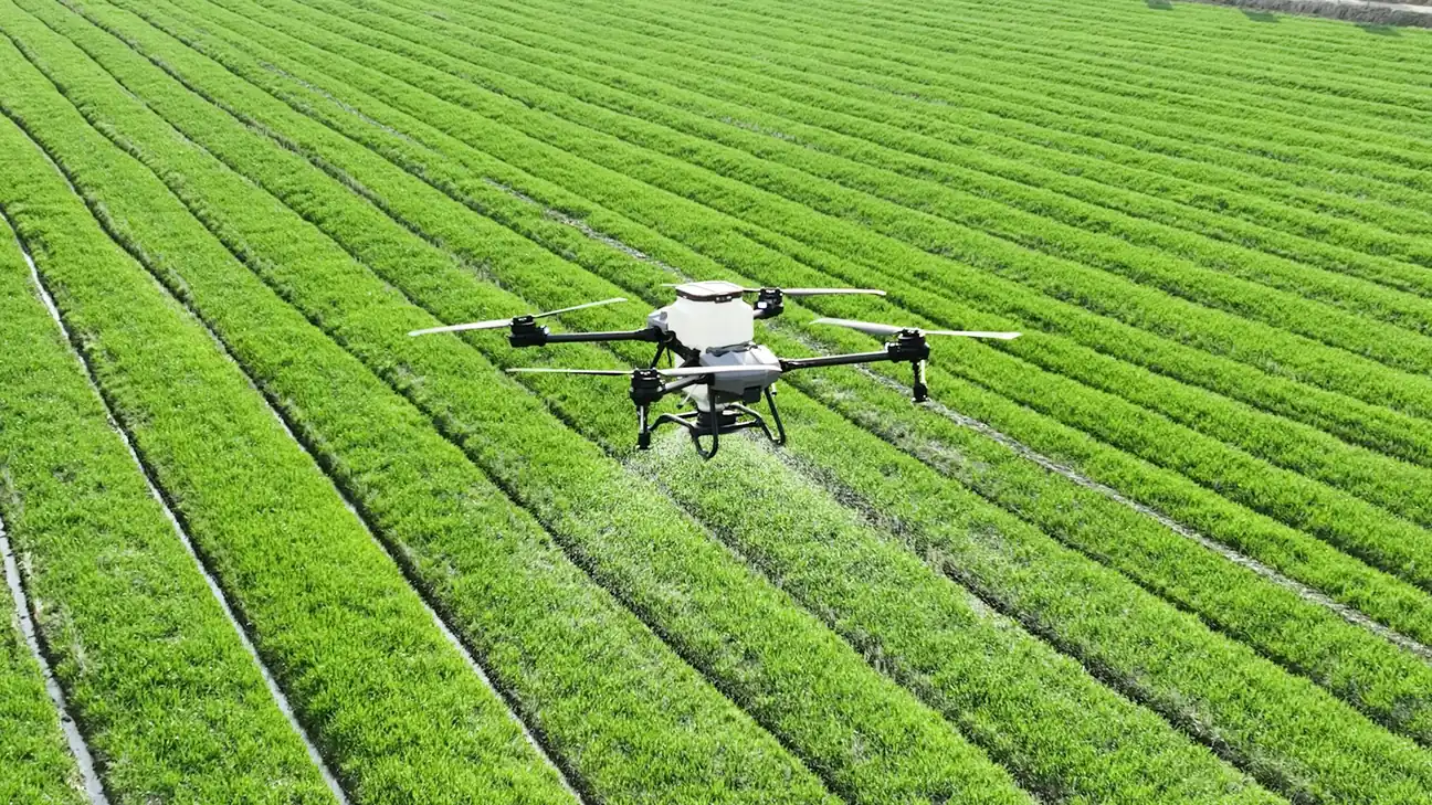
Farming is a business of decisions made under uncertainty: when to irrigate, when to spray, when to harvest, which animal is sick, which field is underperforming and why. For most of history those decisions were made by walking the land. IoT in agriculture replaces some of that walking with sensors that report continuously, and it replaces some of the guessing with measurement.
The sector is also one of the hardest environments for connected devices. Fields are large, far from power and often far from any network. Devices get rained on, driven over, chewed by livestock and buried in soil. Margins are thin and the people buying the technology are rightly skeptical of anything that needs an IT department.
This guide explains what gets sensed, how data gets out of a field, where precision agriculture delivers, and what makes projects fail.
What gets measured
Soil. Moisture at one or more depths is the single most valuable measurement, because it drives irrigation. Temperature, electrical conductivity (a proxy for salinity and nutrients) and pH come next. Probes are buried at the root zone and report a few times an hour; the readings change slowly, so low data rates and long sleep intervals are fine.
Weather and microclimate. On-farm weather stations measure rainfall, temperature, humidity, wind and solar radiation at field level, which differs from the regional forecast enough to matter for frost warnings and spray timing. Leaf wetness sensors feed disease models for crops such as grapes and potatoes.
Crop condition. Cameras on fixed posts, drones and satellites give vegetation indices that show stress before the eye can. This is computer vision territory and increasingly runs at the edge on the device that captures the image.
Livestock. Ear tags and collars with accelerometers and temperature sensors detect estrus, lameness, calving and illness from changes in movement and rumination patterns. Rumen boluses measure internal temperature and pH. Location tags track grazing and find animals on large ranges.
Machinery and infrastructure. Tractors and harvesters are rolling telematics platforms reporting position, fuel, yield and implement status. Pumps, valves, grain silos, cold stores and water tanks get level, temperature and status sensors so that failures are noticed before they spoil a crop.
Getting data out of a field
Connectivity is the defining constraint. A field has no Ethernet and often no cellular coverage, and a sensor may need to run for years on a battery or a small solar panel.
LoRaWAN is the workhorse for fixed sensors. A single gateway on a barn roof covers several kilometers of flat farmland, nodes run for years on batteries, and the farm can own its gateway and network without an operator. The low data rate is no limitation for soil and weather readings. Many agricultural sensor vendors ship LoRaWAN by default for this reason.
NB-IoT and LTE-M work where operator coverage exists and remove the need to own a gateway. They suit scattered assets (a pump here, a tank there) and anything that moves between farms. Roaming and rural coverage gaps need checking before committing.
Satellite IoT fills the remaining gaps for remote stations and livestock on large ranges, at higher cost per message. Wi-Fi HaLow and private networks appear in greenhouses and intensive operations where more bandwidth is needed close to buildings. Drones and tractors carry data back on their own when they return, a legitimate pattern for imagery too heavy to transmit.
Energy harvesting from small solar panels is common for anything above ground; buried sensors rely on multi-year batteries and aggressive duty cycles.
From data to decisions
A soil moisture reading is only useful when it changes an action. The practical systems translate sensor data into recommendations or automated control:
- Irrigation scheduling: combine soil moisture, crop stage, weather forecast and evapotranspiration estimates to decide when and how much to water, then open valves automatically or send a schedule to the farmer. Water savings and yield gains here are the most consistently documented benefit of agricultural IoT.
- Variable-rate application: use field maps built from sensors and imagery to apply fertilizer, seed and pesticide at different rates across a field rather than uniformly, reducing inputs where they are not needed.
- Disease and pest models: feed microclimate data into models that predict infection risk windows, so spraying happens when it matters and not on a calendar.
- Livestock alerts: flag an animal whose activity pattern departs from its baseline, which is anomaly detection applied to a herd, so a worker checks it the same day.
- Frost and storm warnings: local sensors trigger wind machines, sprinklers or covers before damage occurs.
Much of this runs in the cloud, where the farm’s data meets weather services and agronomic models. The exception is anything on a vehicle or a camera, where edge computing handles the heavy processing and only results travel.
What makes projects succeed or fail
The successes share traits. They measure something that directly drives a frequent, costly decision (irrigation, feed, spraying). They use hardware rugged enough for the field and simple enough to be installed by farm staff. They deliver output in the form the farmer already uses, often a phone notification or a line on a familiar farm management platform, rather than a new dashboard. And the connectivity was tested on that farm, not assumed from a coverage map.
The failures are familiar. Sensors that need recalibration nobody performs, so the data drifts into uselessness. Networks that worked in summer and died when the corn grew tall enough to block the signal. Platforms that lock data in a vendor’s cloud, so switching suppliers means losing years of history, a form of vendor lock-in that farmers have learned to distrust. Dashboards with no recommendation attached. And business cases that assumed a large farm’s economics on a small farm’s budget.
Data ownership deserves a specific mention. Field data, yield maps and animal records are commercially sensitive, and contracts with equipment makers and platform vendors should state who owns the data, who may use it, and how it is exported. This is a live issue in the industry and a fair question for any buyer to ask.
Where to go next
- LoRaWAN explained covers the network most fixed field sensors run on.
- NB-IoT and LTE-M explained explains the cellular alternative for scattered and mobile assets.
- Types of IoT devices and the constraints that shape them explains the power and ruggedness budgets that agricultural hardware lives within.
Topics: agriculture, precision agriculture, LoRaWAN, soil sensors, livestock